Author: mike

  • telephoto compression

    A while back I decided to do a series of posts called 7shots. The plan was to do a blog post with at least 7 images at least once per week, and each post would have some sort of common theme. The goal of this series was to get out and use my photography equipment, especially the stuff that I don’t use very often, such as prime/macro lenses or my flash. With the year almost over I only have around 20 of these posts, so I’ve obviously been lazy.

    IMGP4939

    So anyways, I recently bought a new lens, the Pentax 18-135mm. I bought the lens because I wanted something smaller and lighter (and cheaper) to use while traveling. It’s the small lens on the left side of this image, and while it’s smaller than the other two lenses in the picture, it covers almost the entire range of both the bigger lenses combined. Plus it’s still weather sealed, which makes it great for all the dusty and wet environments that I often find myself hiking in.

    IMGP4941So a 7shot post would be a good way to get to know this lens. It’s a lens with a fairly long zoom range, with exactly 7 focal lengths printed on the lens. That makes the theme of this post easy enough. I’ll just take an image at each of these focal lengths to see the effects of telephoto compression on a landscape shot.

    This series was shot at the Mexican Hat in Utah. The car didn’t move between shots. The Mexican Hat didn’t either. The only things that are changing between shots are the focal length and my distance from the car.

    IMGP4637The lens at it’s widest, 18mm. I shot this from a few yards away from the car.

    IMGP4638Here is the same scene at 24mm. I had to step back a few more yards to get both the car and the Mexican Hat in the frame.

    IMGP463935mm. Again farther back, but zoomed in more.

    IMGP464050mm. I’m a few dozen yards away already. I’m gingerly picking my way through the cactus to get farther away.

    IMGP4641

    70mm. I’m really in the weeds (and cacti) at this point. Here you can really start to see the effects of telephoto compression. Even though the car and the rock haven’t moved, the distance between them appears a lot smaller. The rock in the background appears a lot bigger now.

    IMGP4642At 100mm I’m starting to run out of room. I’m probably at least a football field length away. I can’t fit the Mexican Hat into the frame anymore, I can just get the base of the rock into the frame.

    IMGP4643One last shot at 135mm, fully zoomed in on this lens. It’s hard to tell from the image, but I’m really far from the car at this point. I had a long walk back to the car through the weeds and cacti, and stupidly enough I was wearing flip flops. And my friend Tim was wondering what the heck I was doing so far away…

    This was a nice little exercise to get to know my lens better. I’ve heard it often said that you should buy a prime lens and zoom with your feet. That’s true to a certain extent. But if you use a zoom lens and move around you have a lot more options for framing your images. You can use the wide end to make the foreground more prominent, or you can use the long end to make the background appear closer. That sort of flexibility is lacking with a prime lens.

    So anyways I’m glad to have this lens for when I’m outdoors. Granted there are some big trade-offs. The lens isn’t as sharp (especially at the long end of the zoom) as its two bigger brothers. There’s a fair amount of chromatic aberration. It’s especially visible on the upper left of the 100mm shot , the purple fringing where the rock meets the sky. But on the plus side it’s nice to have this much flexibility in one lens. Hopefully I won’t be too lazy to move around and make the most of it.

  • arches after dark

    Mesa Verde was more or less the last scheduled stop on our whirlwind road trip through the American southwest. We had flown into Vegas, from there it was about 2.5 hours to Zion. From Zion to Page, the city in Arizona where Antelope Canyon and Horseshoe Bend are located, was also about 2.5 hours. And then from Page to Mesa Verde was about 3.5 hours. So backtracking back to Vegas we were looking at a good eight hour drive at least.

    Screenshot_2013-11-17-21-11-02Google maps gave us three different routes. The center route more or less backtracks the way we came. There was also a southern route, which would take us through Flagstaff. Then there was a northern route, the longest route back by almost 100 miles, yet only about half an hour longer. That was the route we decided to take, since it took us through Arches National Park. Leaving Mesa Verde early in the afternoon, we would make it to Arches in time for the sunset, and then we would be able to take some star shots through one of the famous arches in the park.

    IMGP4748We arrived at the ‘Windows’ section of Arches National Park a little bit before the scheduled sunset. I saw the North Window, and thought that it would be a great frame for the sunset, so I ran up these steps to try and get to a spot where I could shoot through the arch toward the horizon. Well at least I tried to run– I got about halfway before I started wheezing and gasping for air. I blame the high altitude and the cold air (but in truth I’m just in crappy shape).

    IMGP4751When I got to the North Window I found that the ground on the other side of the window was steeply sloped downward, so if I were to use the window as a frame, I would not be able to see the horizon. Unless I had a fish-eye lens, the best I could do is get a small portion of the window with the sunset. But then as I took this test shot, I saw that the turret arch was in my frame. Since the sun was rapidly dropping toward the horizon, I didn’t have enough time to find a spot where I could frame the sunset in the arch, but at least the arch made for an interesting foreground.

    IMGP4781This is the sunset shot that I ended up with. Not too bad. I had bracketed a couple of exposures, so maybe I’ll eventually end up print an HDR version of this shot (which would make the arch less dark) but for now I’m too lazy to put that much effort into post processing.

    IMGP4792Afterwards we headed to the nearby Double Arch. This is a pretty famous spot for star photography. Here we played around with different exposure lengths and different amounts of light painting of the arch while figuring out how to frame our shot. This is more or less the framing that we decided on.

    IMGP4798This is the shot that I ended up with. A twenty minute exposure, and several passes of the arch with my headlamp. You can see that an airplane passed by, and another photographer in the lower right was shining his headlamp upwards, creating a bright spot on the right side of the rock. Plus the foreground could use more brightening. But overall I’m happy with the picture I got.

    IMGP4807Near the double arch was a rock that looked sort of like a giant’s head. So we tried to take a picture of the giant looking at the Milky Way. The Milky Way isn’t as pronounced as it is in summer, but I’m still more or less happy with the image.

    So in the end I ended up with three pictures that I’m more or less happy with. Probably if I had more time, I would’ve come away with even better images, but for the time we spent there I’m happy with the pictures I got.

    And this trip made me realize that for the first time in my life I’m happy with the photography gear that I have. It’s almost a year ago now that I had bought a D600 and then returned it. Most people said I was crazy– the Nikon D600 is a far superior camera. It’s true, the D600 is a better camera, especially for these sorts of very low light or very high dynamic range shots. But my Pentax K-5 handles those situations well enough for me, so I’m happy with the decision I made to stick with Pentax. And it saved me a lot of money on lenses, money that will hopefully be used to see even more of these amazing landscapes.

  • mesa verde

    Mesa Verde National Park is located in the southwestern part of Colorado. It’s famous for it’s cliff dwellings, built by the Ancestral Pueblos who lived in the cliff dwellings almost a thousand years ago.

    spectacular drive into mesa verdeThe drive into the park is pretty epic, a winding road built into the side of a mesa.

    the crazy geographyMesa Verde means Green Table in Spanish. It’s easy to see why. The Ancestral Pueblo natives built their houses into the sides of cliffs like this. You can sort of see one towards the right side of this image.

    smaller cliff dwellingA closer view of the same cliff dwelling.

    one of the largest cliff dwellingsOne of the larger cliff dwellings– I think this one is called Long House.

    ranger led tour of one of the dwellingsThe park offers ranger guided tours of some of the cliff dwellings, but in the winter they are closed except for this one, the Spruce Tree House.

    switchbacks to the cliff dwellingThe trail to the Spruce Tree House has many steep switchbacks built by the National Park Service. In ancient times though, the cliff dwellers used ropes and wooden ladders, along with toe holds carved into the cliff to access their house.

    learning about the siteThe cliff dwellings were amazing up close, and the history of the area is pretty fascinating. There are several theories as to why the cliff dwellings were built, as well as theories why they were abruptly abandoned in the 1300’s, which the ranger presented.

    2013-11-05 - mesa verdeThere were also round underground rooms, called kivas, which they speculate were used for religious ceremonies.

    harsh environmentWith a name like Mesa Verde, you’d expect there to be a lot of green, but in truth a lot of the area at the top of the mesa was pretty barren. It seems like a pretty harsh environment to live in.

    Usually I visit national parks for the amazing natural scenery. Mesa Verde was a bit different in that there isn’t any spectacular natural scenery– it exists solely because of the cliff dwellings. Apparently it’s the only cultural park in the national park system. It’s a bit remote, far from any major cities, but it was definitely worth the trip. I’d definitely recommend going sometime other than winter though, so that more of the cliff dwellings are accessible.

  • antelope canyon

    Antelope Canyon is probably the most famous and most photographed slot canyon in the world. I’ve seen it in pictures many times, in magazines, in galleries, and even in framed photographs on friends’ walls. It’s a place that I’ve wanted to see in person for a long time, and I finally got to visit and take my own photographs there this week.

    IMGP4602Antelope Canyon is on Navajo Indian land, and the only way you can visit is through guided tours. Our tour started with a ride on the back of a 4×4 pickup truck. The ride was fast and bumpy on the rutted road (if you could call it a road– it was more just a large expanse of packed sand), and it was actually kinda scary because we kept bouncing out of our seats.

    IMGP4570The entrance to the canyon is about three miles from the parking area. Just from the entrance you can already tell that this is going to be a pretty cool experience.

    IMGP4503Our Navajo guide was a pretty experienced photographer. She had recommended ISO and white balance settings for us to use, and at various times during our tour she pointed out places to stand to take pictures. She had names for many of the features we were photographing.

    IMGP4530She called this one the sunrise.

    IMGP4548This one is the wave.

    IMGP4525This one forms the shape of a heart.

    IMGP4557This one is called Monument Valley– I thought this one was pretty cool, it does kinda look like one of the iconic monolithic monuments from that famous valley in lower Utah.

    IMGP4565Our guide grabbed my camera, sat down in the sand and pointed my lens at what I thought was a random rock to frame this photo of a wolf for us. That was really cool– you had to really know the canyon to get this shot.

    IMGP4614After our tour of Antelope Canyon we made a quick stop to Horseshoe Bend, another famous photo spot that was less than fifteen minutes away.

    IMGP4629From there we drove east to the Monument Valley. After the craziness of Antelope Canyon and Horseshoe Bend, the Monument Valley was sort of disappointing. I actually like the picture of the fake ‘Monument Valley’ from Antelope Canyon better.

    IMGP4640We just kind of drove quickly through the valley, making a quick stop at the ‘Mexican Hat’ at the end of the valley. It looks more like a mushroom than a hat to me.

    IMGP4646From there we made a slight detour to the ‘Four Corners’ monument. I’ve been to all these states before, but never all four at the same time, so I guess it was worth the steep cost of admission for this photograph of my dirty feet in all four states.

    It seems that I’ve done a road trip in this southwestern region almost every year now, for at least the last five years. But I think with this last trip I’ve seen most of what I’ve wanted to see in the region (except for maybe Havasu Falls), so this may actually be my last trip to the area for a long time. I’m glad to have finally seen and photographed the Antelope Canyon– it definitely did not disappoint.

  • the subway

    Zion National Park is one of my favorite places. It’s home to spectacular hikes, including Angel’s Landing, the Zion Narrows, and the Subway. These three hikes form an amazing trilogy of hikes, a trilogy that for me was finally completed this weekend, almost exactly three years after first hiking the Narrows in 2010. I did this hike with my old high school buddy Tim, who also did the Narrows a few years back with me.

    IMGP4240The hike to the Subway starts high above a steep river canyon.

    IMGP4243First order of business is hiking down the steep slopes of the canyon walls.

    IMGP4259Once you get to the bottom, there’s not really a trail– you spend most of the time finding your way along the river, sometimes walking right through the river.

    IMGP4334At times scrambling over boulders.

    IMGP4371Or squeezing between them.

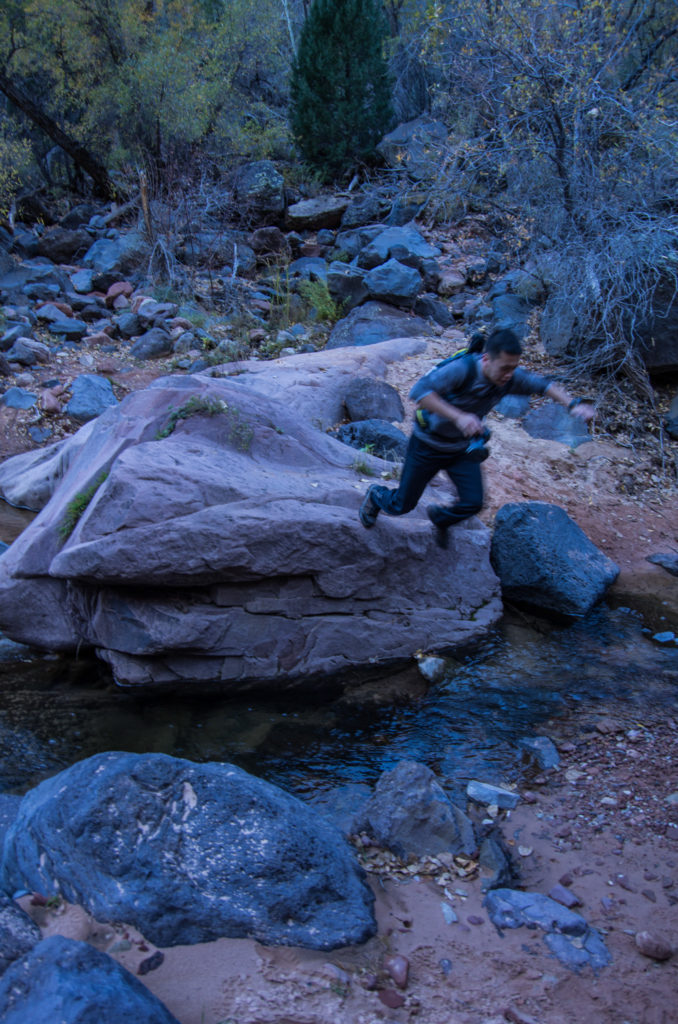
    IMGP4285Sometimes jumping off of them.

    IMGP4394And sometimes walking underneath overhanging ledges.

    IMGP4375Along the way there is some beautiful scenery, including these red rock steps.

    IMGP4409The water carves some interesting features into the solid rock.

    IMGP4436The most interesting and famous of course, is the Subway, the end goal of this hike.

    IMGP4429It’s a quite popular spot for photographers.

    IMGP4440There are two ways to hike the Subway– the bottom up approach that we did is apparently the easier way. It dead ends here. The top down approach starts several miles up on a higher part of the river, and requires several rappels, including this one right past the subway.

    IMGP4455After taking a few pictures we started our hike out of the canyon. I felt pretty beat up after the hike, and my whole body was sore when I woke up the next morning. It was definitely a difficult hike, but definitely worth it. It’s hard to do justice to this hike with words and pictures, it really is an amazing hike, I think it definitely needs to be experienced in person, and I was glad to have finally gotten to experience it.

  • foxy’s. finished. finally.

    The Foxy’s Fall Classic Century is my hometown ride. I’ve signed up for it numerous times, but for some reason or other I’ve never finished the 100 mile course. The last time I attempted it, it was a bent rear wheel that prevented me from finishing the long course. Other times I ended up riding the shorter 100 km course simply because that’s what my friends were riding. It’s not a difficult ride. In fact, out of all the 100 mile courses I’ve done, it’s probably the easiest. There are no huge hills and none of the high elevation climbing that I had to deal with on my last two rides.

    A walk in the park. Or so I thought.

    On a century ride I typically bring along an assortment of gels, bars, powders (gatorade) and (electrolyte) pills to get me through to the end. Having done several harder rides this year, I guess I was overly confident or prideful in my endurance and fitness, so I didn’t bring any of that stuff this time.

    Ahh hubris. I like this definition of hubris I found on freedictionary.com: an excess of pride ultimately causing the transgressor’s ruin. Sounds about right. That bit of hubris in not bringing any of my normal nutritional supplements almost did cause my ruin.

    The ride started out easy enough, through familiar territory between Davis and Winters, on roads that are completely flat. On the edge of Davis I found myself in a nice paceline, which I rode with all the way to the first rest stop.

    Photos5The first stop was pretty well stocked, with the normal century ride staples like baked goods, salty snacks, and various fruits. I loaded up on cookies, since, well… I love cookies. And during a long bike ride like this is really the only time I can eat as many as I want guilt free.

    IMG_20131019_091645

    The second stop was a water only stop. There were no calories at all, except for Cytomax, which I hate the taste of. So I filled up on water, and wished I had eaten more cookies at the first rest stop.

    Between the second rest stop and the third rest stop is where I could have used some of the gels or bars that I normally bring. Somewhere around mile 40 I was starting to hit the wall, I was seriously starting to run low on energy. Cyclists call it bonking, I guess because a bike hitting a wall tire first would make a ‘bonk’ noise as it bounces off the wall. All I had on me was a granola bar that I had picked up at the first rest stop. I wolfed it down, along with some water, and slowly made my way to the third stop.

    Photos6The third stop was the lunch stop. I rode into the stop completely drained, but for some reason I didn’t have an appetite. I could barely stomach a sandwich, some chips, and half a banana. On most rides lunch comes with sodas, but for some reason all they had was V8 and more Cytomax. I ended up chugging a couple of cans of V8. Surprisingly, it really hit the spot. There’s a good amount of salt and potassium in V8, which I hoped would take the place of the electrolyte pills I would normally be popping to prevent cramps.

    IMG_20131019_121215After lunch was the climb to Lake Berryessa. I’ve been to this spot many times, but never have I been so happy to be here. I was happy because despite still being 35 miles from the end, this was the home stretch, it was mostly just downhill and flat all the way back to Davis.

    6D6T6897They had a camera posted on the descent from the lake, and thankfully they provide the photos for free.

    Photos7The final stop was at Lake Solano Park. Here they had sodas. I chugged two cans, and filled my bottle with another. The candy bars boosted my blood sugar a bit more, and V8 again replenished my electrolytes. For the first time since the first rest stop, I was starting to feel energized again.Photos8

    The awesome thing about Foxy’s is that for pretty much the entire ride you can find a paceline. I found one between every set of stops, but I got dropped by all of them except for the first one that I rode into the first rest stop. I think coming close to bonking so early in the ride killed my endurance. Even after being re-energized at the last stop, I was dropped by my last paceline, which was unfortunate, because several of the riders (in the purple jerseys on the right pic) seemed to be part of an interfaith cycling group that I would’ve liked to have joined. I looked for them at the end of the ride, but I couldn’t find them– they had probably finished dinner and left by the time I got to the end.

    IMG_20131019_144036

    I finished the ride in just under six hours. But I can’t help but think that if I had been better prepared, I would’ve done much better. There were good pacelines above 20mph the entire way– if only I didn’t get dropped by then I could’ve finished in close to five hours.

    IMG_20131019_145555The pasta dinner at the end was tasty, but I didn’t have an appetite. I could barely finish the lasagna and pasta and ended up tossing the salad in the trash. That’s very uncharacteristic of me… usually I’m famished at the end of any exercise.

    Photos9I thought something was wrong with my body, but after a few hour nap I was back to my old hungry self again. I ended up hitting Fuji’s for a friend’s birthday (happy birthday Fan) and regained most of the calories I had burned on the ride.

    So anyways, after many attempts, I have finally finished the 100 mile course of the Foxy’s Fall Classic. And I learned a valuable lesson. Always be prepared, even if you think something’s so easy that you don’t need to prepare. Oh yes and one more lesson. Pride/hubris is a dangerous thing. It led to the downfall of Greek heroes, and it almost led to the downfall of this Korean-American cyclist.

  • the maine lobster roll

    After a whirlwind tour of Montreal, we headed back across the border to the US, crossing back into our homeland somewhere in Vermont. Vermont for the most part was forgettable to me, we had one meal in the state capital, Montpelier, which was a surprisingly tiny town where we ate a surprisingly terrible meal considering how much we paid. From there we headed east to the coast of Maine.

    Photos4

    Our first stop was in Kennebunkport, Maine to a place that, despite being called the Clam Shack, was famous for its lobster roll. A lobster roll is pretty simple– a pound of lobster sandwiched between two toasted buns, slathered with some mayo and butter. At about $15, it was one of the most expensive sandwiches I’ve ever eaten, but worth every penny.

    IMG_20131010_132444

    Right next door to the Clam Shack was a bar/restaurant that served steamed lobster. The place was packed, both with tourists and locals, probably because they served a steamed lobster combo for $15.

    Photos3

    We stopped at another somewhat famous clam place–it had been featured on Diners, Drive-ins & Dives. This one was famous for its lobster stew.

    IMG_20131010_151336

    My favorite place ended up being a tiny roadside lobster shack. It was the complete opposite of all the places we had been to so far in that it was completely empty.

    Photos1

    Here they had live lobsters in various sizes. We picked four of the #2 size, which came to around $30 in total.

    Photos2

    They had a big steam pot outside which they tossed the live lobsters into. About ten minutes later they pulled them out and tossed them into a shopping bag. They gave us a couple of paper plates, then we chowed down on the lobsters on the picnic table outside.

    IMG_20131010_164041

    Our last stop in Maine was at the Chauncey Creek lobster pier. This was a more touristy sort of place, so the lobster was quite a bit more expensive here.

    Photos

    Instead of lobster I ordered some steamed clams and raw oysters. They were super fresh too, simply prepared, but super tasty.IMG_20131010_164905I’m a huge fan of shellfish in general, but lobster actually has probably always been my least favorite. I’ve always enjoyed crab more. From eating lobster in Maine, I came to the realization that I wasn’t a huge fan of lobster mostly because I’ve never had access to any good fresh lobster. I’ve always had access to super fresh crab– one of my family’s traditions is to buy live fresh caught dungeness crab off the boats in Half Moon Bay. I’ve never had access to that same sort of fresh lobster– most of the lobster I’ve had up until now had been crappy frozen lobster at places like Red Lobster or random seafood buffets.

    So yeah, eating fresh lobster in Maine was a revelation to me. Like many revelations, this one will probably end with semi annual pilgrimages to a holy land– in this case I’ll be rolling back to the holy land of lobster that is Maine.

  • montreal at night

    The first part of our little week long road trip was planned out pretty well. We stayed one night at Caleb’s place near Cornell. Then we had booked one night at a hotel overlooking Niagara falls. From there we went to Toronto. After Toronto we had nothing planned yet. So we decided we would continue driving east into Montreal and then back to the US through Vermont to eat lobster in Maine. Since we had not planned this in advance, Bo looked for a hotel room near downtown Montreal that was relatively cheap, but still had good reviews.

    OLYMPUS DIGITAL CAMERASo when we arrived at our hotel we had a little surprise. Our hotel was above a sex shop. Still, the hotel room wasn’t too bad. It was comfortable and clean, and much cheaper than any of the other hotels nearby. It gives new meaning to the phrase ‘bang for the buck.’

    OLYMPUS DIGITAL CAMERAAnd on the plus side, it appeared that Chinatown wasn’t too far away. I wanted to walk to Chinatown and the Notre Dame Basilica, which according to Google Maps was only about a ten minute walk away. First I googled: ‘is it safe to walk in Montreal at night’ to which most pages on Google responded with a resounding ‘yes.’

    It was sort of a semi walk of shame for me, because even though Chinatown was only about two blocks away, those two blocks were filled with strip clubs and sex shops. And even though I didn’t go into any of those seedy establishments, I would bet that most people would assume that a guy walking at night through the area would be a patron of those establishments. So yeah– semi walk of shame.

    OLYMPUS DIGITAL CAMERAThe Chinatown gate, guarded by a lion. Seems like this is a fairly standard thing in most Chinatowns I’ve been too. There must be some story behind the lions that I’m unaware of.

    OLYMPUS DIGITAL CAMERAAccording to Yelp there were still some restaurants open in Chinatown, but when I arrived Chinatown seemed sort of creepy and deserted, so I didn’t walk through it.

    OLYMPUS DIGITAL CAMERAThe Notre Dame Basilica.

    OLYMPUS DIGITAL CAMERAFire Station in Downtown Montreal. Boots and overalls ready for action.

    OLYMPUS DIGITAL CAMERAGreen and Yellow lights, as opposed to the red light district that our hotel was in.

    Aside from the area near the strip clubs, the streets were fairly deserted. Even though I guess we were in sort of a seedy part of town, I felt pretty safe compared to most American cities I’ve been to, but I didn’t tempt fate by staying out too long. After taking a few pictures I hurried back and fell asleep safely locked in the room above a sex shop.

  • steam whistle brewery

    Across the street from the CN Tower is an old train roundhouse that has been converted into the headquarters of Steam Whistle Brewery. The brewery brews one kind of beer, a pilsner, and offers a brewery tour. This tour ended up being one of the unexpected highlights of Toronto for me.

    OLYMPUS DIGITAL CAMERAThe brewery is near the Toronto waterfront, directly across the street from the CN Tower.

    OLYMPUS DIGITAL CAMERA

    The tour takes us through the brewery. We visited towards the end of the day, so workers were busy filling up pallets of beer.

    OLYMPUS DIGITAL CAMERA

    Beer apparently is pretty simple. Steam Whistle only uses four ingredients. Hops, malt and spring water, to which yeast is added to start the fermentation process.

    OLYMPUS DIGITAL CAMERAA technician monitors the fermentation process. The monitoring happens 24×7 because apparently beer never sleeps.

    OLYMPUS DIGITAL CAMERAPeople in lab coats monitor every step of the process.

    OLYMPUS DIGITAL CAMERAThis crazy machine is the heart of the operation. It cleans, fills and caps the bottles of beer.

    OLYMPUS DIGITAL CAMERAAt the end of the line the bottles are packed and loaded onto pallets by hand.

    OLYMPUS DIGITAL CAMERAWhen the working day is done, boys just wanna have fun… Apparently workers at the brewery get free beer, and often enjoy a few bottles at the end of their shift. It’s a pretty cool place to work, just across the street of the CN Tower, which you can sorta see the base of in this picture.

    OLYMPUS DIGITAL CAMERAThe finished product, a bottle of pilsner from ‘The Good Beer Folks!’ The tour was $10 and included a bottle of beer which was bottled just hours ago, a souvenir glass, and a couple of tastings of beer. Not a bad deal in my opinion.

  • the CN tower

    The CN Tower is one of the most famous landmarks in Toronto. For thirty four years, up until the completion of the Burj Khalifa in 2010, it was the world’s tallest man-made structure.

    OLYMPUS DIGITAL CAMERA

    We arrived at the CN Tower at night, about a half hour before closing, but the guy at the ticket booth said we should come back in the morning and devote at least an hour to the tour.

    OLYMPUS DIGITAL CAMERAThe tower is reflected off of many of the buildings in downtown Toronto.

    OLYMPUS DIGITAL CAMERA


    The CN Tower towers over all the buildings in downtown. (This distorted view from my wide angle lens makes the tower seem even taller than it should be. It’s really only like twice as tall as all the other buildings in Toronto.)OLYMPUS DIGITAL CAMERAAn elevator ride takes you to the top of the tower. At the halfway point of the elevator ride you’re at the level of most of the downtown skyscrapers.

    OLYMPUS DIGITAL CAMERABut from the observation deck it’s clear how much taller the tower is than surrounding buildings.

    OLYMPUS DIGITAL CAMERAThe lower floor of the observation area has an open air deck that wraps around the tower. It’s pretty cool. Literally. A cold great lakes breeze blows through the protective mesh barrier.

    OLYMPUS DIGITAL CAMERAThere is a glass floor which you can stand on and gawk at the pedestrians who are more than 1500 feet below you.

    The tower tour was pretty cool, but at $35 I thought it way overpriced. I think closer to $10 would’ve been more appropriate.

  • st lawrence market

    When traveling I like to visit the local food market. So when I discovered that Toronto had a pretty famous one, the St Lawrence Market, rated as one of the best in the world by National Geographic, I had to check it out.

    OLYMPUS DIGITAL CAMERAThe market is housed in what appears to be a converted brick warehouse.

    OLYMPUS DIGITAL CAMERAFirst order of business: find some coffee. Then roam around the market looking for food.

    OLYMPUS DIGITAL CAMERAThere were several coffee dealers. I was tempted to buy some of ‘Mike’s Blend #3’ since it had my name on it. But I don’t own a coffee grinder. I should probably buy a grinder and a french press.

    OLYMPUS DIGITAL CAMERAThe market is a large indoor market with many different seafood and meat vendors, kind of like Pike’s Place market in Seattle, but smaller and not as crowded.

    OLYMPUS DIGITAL CAMERAThey had fresh oysters and clams.

    OLYMPUS DIGITAL CAMERAThey shuck the oysters and serve them right there for you if you so desire. In hindsight I should have ordered more than three. They were quite tasty.

    OLYMPUS DIGITAL CAMERAThe smoked salmon from Mike’s Fish Market was calling out to me. How could I resist fish from a market with my name on it?

    OLYMPUS DIGITAL CAMERAAfter wandering around the market for a bit, I settled on what to buy for lunch. A bit of smoked salmon, some herbed goat cheese, a few sun-dried tomatoes, and a small french baguette. It was quite a tasty meal, though not as tasty as the magical market meal I had in the Nachsmarkt in Vienna. Overall I was a bit disappointed with the St Lawrence Market. Because it was rated so highly by National Geographic, I was expecting it to be truly amazing, but I found it to be more or less on par with the other markets I’ve been to.

  • waterfalls of upstate ny

    Upstate New York has some amazing scenery, and I was fortunate to be landing in the area near the peak foliage season.

    IMGP4069First stop on this road trip was to Ithaca, New York. I met my friend Bo at the airport in Newark, and from there we went to visit Caleb in Ithaca. He’s there finishing up his studies at Cornell. Ithaca is a nice little scenic college town, with a waterfall right in the middle of town.

    IMGP4073Our next stop was to Rochester, to visit some friends there, but along the way Caleb led us to another waterfall called Taughannock Falls. This one was pretty amazing, with beautiful fall foliage surrounding the waterfall.

    IMGP4090After visiting friends in Rochester, and after a quick stop in Buffalo at Anchor Bar for the original Buffalo wings, we arrived at Niagara Falls. Technically we were on the Canadian side, so technically the title of this post should be “Waterfalls of Upstate NY and Canada.” We arrived at night at our hotel. Our hotel room had an amazing view of the waterfall, which was lit up with colored lights.

    IMGP4092Waking up to this view was pretty amazing.

    IMGP4124The park on the Canadian side of the waterfalls is very developed– it’s almost like a theme park. It’s much different experience from when I visited the American side in winter, when everything was closed.

    IMGP4104We wanted to ride the Maid of the Mist, but when we arrived at the ticket stand they were closed due to ‘high water.’ It had rained earlier in the day, so I’m guessing the river was running high, making it unsafe for the boat to go out.

    PANO_20131007_132346I took a panoramic on my phone– it ended up being one of my favorite pictures from the trip. I found out that the panoramic mode actually uses the camera in lower resolution. So I’m actually better off using a wide angle lens on my SLR and cropping if I want an image that I can print.

  • jaoquin miller / redwood park

    Today I had plans to grab dinner with my friend Jason near Berkeley. Since I didn’t have anything planned for the afternoon, I decided to take my mountain bike for a spin in the nearby Oakland Hills. My original plan was to ride in Jaoquin Miller park, but I ended up riding mostly in the adjacent Redwood Regional Park.

    It’s been a while since I’ve done a 7shots post, so I’ll combine the trip report with a photographic theme. For this post all the pictures will be diptychs (and one triptych.)

    jaoquin miller3

    The bad thing about riding in the Oakland hills is that well– we’re in Oakland, which is kind of a high crime area. Apparently there’s been a lot of car break-ins.

    jaoquin millerIt had rained pretty hard on Saturday, so I was worried that the trails would be rutted out. But the trails were so wide that the ruts weren’t a problem at all.

    jaoquin miller4I didn’t realize it at first, but I ended up spending almost all of my day at Redwood Regional Park, instead of Jaoquin Miller park, which is where I had intended to ride. The trails were all well marked, but they were all wide fire roads. Whereas in Jaoquin Miller there’s supposedly some fun singletrack to ride, all of the trails at Redwood Park were multi-use trails, all of the singletrack was illegal to ride, with hefty fines for riding single track or even riding fast.

    jaoquin miller5I ended up getting lost and spent a good part of the day riding on pavement. Thankfully somewhere along the way I found a map of Redwood park. Riding on pavement wasn’t bad, towards the end of the day I rode up Skyline Blvd on my way back to my car. There was a nice view of the bay from that road. I only wish i were on my road bike, which would’ve made the long climbs on the pavement easier. This seems to be a common theme when I ride trails in the bay area. I bring my mountain bike, but end up wishing I was on my road bike instead.

    jaoquin miller2On Skyline Blvd there’s a science center with an observatory. Apparently there’s free viewings on Friday and Saturday evening. This sounds like a good idea for a date to me– mountain biking around the park, grabbing dinner at a nice bistro in Berkeley, then returning to go stargazing at the observatory. I found the observatory, now I just need to find a girl who keeps up on the mountain bike and a nice bistro that doesn’t mind having smelly, sweaty, mud covered guests.

    jaoquin miller1The observatory was only about a half mile from where I parked, and it was still early, so I decided to try and find some more trails to ride. I found a fun little downhill section, which ended up being not so little. It was a seriously fun descent, but it left me several miles away from my car, with a long ascent to get back. This seems to be another theme when I ride– I often find myself lost, miles away from my car, with an exhaustively grueling ride back to my car. People who I’ve ridden trails with before like Geo, LKC and especially DHo know this. In fact it’s probably gotten to the point that when I say, “Hey– there’s this trail I wanna try…” I’m sure by now they understand it to mean, “We are going to get utterly lost and have an exhausting day…”

    !nexusI didn’t eat anything during my ride, though I guess I consumed a fair amount of calories in the couple of bottles of Gatorade I drank. So I was utterly famished by dinner time. Jason picked a Cajun restaurant in Berkeley, which ended up being pretty awesome. I couldn’t decide between the fried chicken or the gumbo, so I ended up ordering both. And I can’t say no to beignets, so I ended up ordering that for dessert. I’m pretty sure that by the end of the meal I had regained all the calories I had burned during my ride, and then some.

  • edible pedal 100

    This weekend I rode in the Edible Pedal 100. I only found out about this ride a few weeks ago, so I ended up paying a pretty hefty late registration fee to enter this ride. But in the end it was worth it– it was a pretty awesome ride.

    OLYMPUS DIGITAL CAMERAThe ride started right around sunrise from Bower Mansion Park, which is about halfway between Reno and Carson City. From there we rode south towards Carson City.

    OLYMPUS DIGITAL CAMERANevada is mostly desert, but as far as deserts go, this area is pretty nice, and not bad for riding.

    OLYMPUS DIGITAL CAMERAIn fact the scenery was quite nice in some parts. It was quite enjoyable, even though the fact that we’d be climbing over these huge mountains was constantly on the back of my mind.

    OLYMPUS DIGITAL CAMERABetween the second and third rest stop I ended up in a really nice paceline, which conserved a good amount of energy for the climb ahead.

    OLYMPUS DIGITAL CAMERAThis is the start of Kingsbury grade, the climb that I had dreaded all morning.

    OLYMPUS DIGITAL CAMERAAfter what seemed like an eternity of climbing, I stopped for a breather at the side of the road. Then I looked up. “Holy shit…” I don’t swear a whole lot, especially when riding (since I usually enjoy biking) but that is what literally came out of my mouth when I saw the climb ahead.

    OLYMPUS DIGITAL CAMERASo it turned out that the part ahead that I was swearing about– that wasn’t even the halfway point of this climb. At 6,000 feet of elevation, there was still another 1,300+ feet that we’d need to climb.

    OLYMPUS DIGITAL CAMERAThis is how I felt about the climb to Daggett Summit. It was brutal, without a doubt the hardest climb I’ve ever done. There was a sign across from here that said it’s a 9% grade for 8 miles. Ridiculous. The descent from Daggett summit was really short– only about 3 miles that were over really quickly. But it turns out that was a good thing– since any elevation lost here we’d have to gain when we climbed back over Spooner Summit to get back to Carson City.

    OLYMPUS DIGITAL CAMERAThe part of the ride between Daggett and Spooner summit was my favorite. At some points during the section the road was right on the shore of Lake Tahoe.

    OLYMPUS DIGITAL CAMERAThere was a pretty cool tunnel during this section (which was kinda scary to ride through.)

    OLYMPUS DIGITAL CAMERAOn my way up Spooner summit I started to get hungry, so I took a break here. It was a nice spot. I sat in the shade and stared at the lake and watched the cars go by while I refueled with my Honey Stinger waffle and Powerade.

    OLYMPUS DIGITAL CAMERAI was quite happy at the top of Spooner summit, since that meant the hardest parts of the ride were over, and there was a huge descent into Carson City. The descent was pretty crazy. Thankfully the road surface was really smooth and the shoulders were clean. But there were these huge drainage gates in the shoulder, which were marked off by cones, but they were so big that they prevented us from riding in the shoulder at all. So I ended up in the right lane riding down interstate 50 at almost 50 miles an hour. By the end of it my hands were cramping up and if I could look underneath my gloves I bet my knuckles would have been white.

    OLYMPUS DIGITAL CAMERAThe elevation chart for this ride’s pretty insane. As you can see the climb to Daggett Summit is a monster. There’s nothing in the Davis/Sacramento area that could prepare us for a climb like that. After the descent from Spooner summit there’s one last climb– that one last climb looks tiny in comparison– that’s the kind of climbs we have in Davis/Sacramento. Cantelow, the hill I train on most often, is about that size– around 800 feet.

    OLYMPUS DIGITAL CAMERASo that last climb doesn’t look that bad. But for some reason there was a stiff wind blowing against me the entire way, which made the climb a lot harder than it should have been. More or less the rest of the way back to the finish line was against a stiff headwind.

    edible pedalThe Edible Pedal 100 was the toughest ride I’ve ever done. But I think I’d do it again. Except for the brutal climbing I enjoyed everything about the ride. The food was really good, with tons of tasty homemade snacks. The post ride meal was incredibly tasty as well, and the support staff was really friendly. I think I just need to do more training on hills and at high elevation before the next time– it’s a good excuse to spend some time in Tahoe mountain biking.

  • eastern sierra hot springs

    I had heard that there were a few good natural hot springs in the Eastern Sierra area on highway 395. But I had also heard that they were kind of hard to find, often on unmarked dirt roads, so I had never really bothered to look for them. This weekend, thanks to Iris and Masa I finally know where some of them are. Over the weekend we went to three different hot springs (though we only went for a dip in one of them.) This post is for future reference, in case I ever want to find these hot springs again.

    Travertine Hot Springs

    Travertine hot springs is right outside the town of Bridgeport. Heading south from Bridgeport on 395 you turn left onto Jack Sawyer road, which turns into a dirt road. After about a mile on the dirt road you see a parking area with a pit toilet.

    IMG_20130831_102807Near the toilet is a tub and picnic table. But there was barely any water in the tub. I think this would only be usable in the spring.

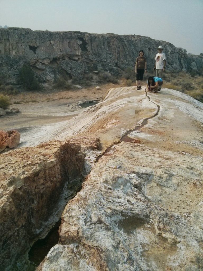
    IMG_20130831_104058There is a more natural looking set of pools a few hundred feet away. These are pretty shallow, but the temperature is pretty nice.

    IMG_20130831_103843You can see where the hot water comes out of the ground and where it flows into the pools below.

    Buckeye Hot Springs

    Buckeye Hot Springs is northwest of Bridgeport. Heading North on 395 out of Bridgeport, you turn left onto Twin Lakes road, and then turn right onto Buckeye road.

    IMG_20130902_114551The hot spring bubbles out of a hillside and flows into a creek.

    IMG_20130902_114512The water bubbles out of the ground at near boiling temperatures– I burned myself touching the water here.

    IMG_20130902_114641There are pools right next to the creek which the water collects into. This seems like a pretty awesome place to bathe, you can always cool off in the creek if it gets too hot. It’s definitely clothing optional– there was a fat naked old man here, so I discretely took a picture of the pools while he was shielded behind the hill and quickly left him to bathe in privacy.

    Wild Willy’s Hot Spring

    Wild Willy’s seems like one of the most popular hot springs, and for good reason. The pool is quite large, it seems to easily fit a couple of dozen people, and it’s deep enough that you can sit neck deep in the water. To get to here you head South on 395 then turn left on Benton Crossing Road. From there you make a right onto a dirt road after the third cattle gate.

    IMG_20130831_201922We only went at night, but even then it was quite popular. It’s pretty well developed too, there’s a boardwalk that leads from the parking area to the hot spring pool.

    IMG_8651I didn’t get to see the hot spring during the day (though it was awesome sitting in the hot spring underneath the stars) so I found this picture online.